Sabine River Basin Reservoirs: Monitored Water Supply Reservoirs are 98.6% full on 2025-02-23
Historical Data
| Date | Percent Full |
Reservoir Storage (acre-ft) |
Conservation Storage (acre-ft) |
Conservation Capacity (acre-ft) |
|
|---|---|---|---|---|---|
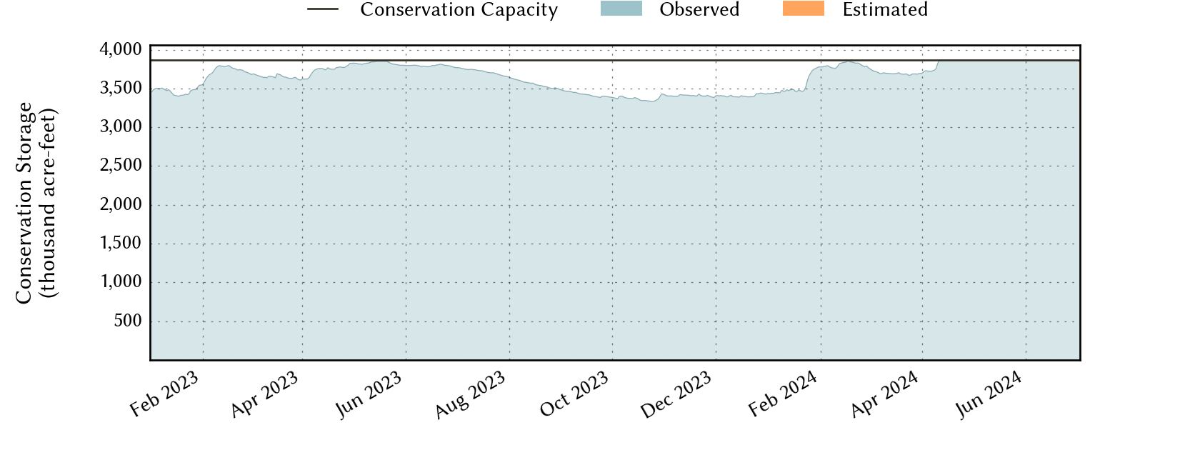
| Today | 2025-02-23 | 98.6 | 6,063,193 | 3,812,920 | 3,867,301 |
| Yesterday | 2025-02-22 | 98.4 | 6,051,418 | 3,806,928 | 3,867,301 |
| 2 days ago | 2025-02-21 | 98.5 | 6,059,791 | 3,811,015 | 3,867,301 |
| 1 week ago | 2025-02-16 | 98.1 | 6,047,214 | 3,793,933 | 3,867,301 |
| 1 month ago | 2025-01-23 | 89.7 | 5,464,085 | 3,468,112 | 3,867,301 |
| 3 months ago | 2024-11-23 | 86.7 | 5,282,047 | 3,353,361 | 3,867,301 |
| 6 months ago | 2024-08-23 | 91.0 | 5,510,056 | 3,518,696 | 3,867,301 |
| 1 year ago | 2024-02-23 | 99.0 | 6,089,962 | 3,828,497 | 3,867,301 |
*
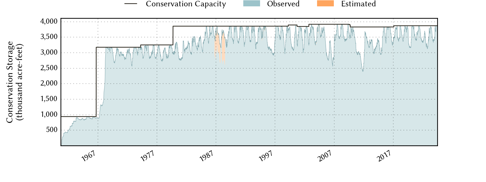
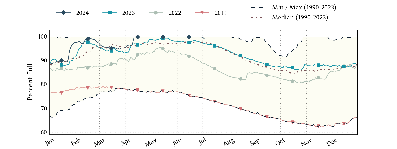
Percent Full is based on Conservation Storage and Conservation Capacity and doesn't account for storage in flood pool.
Area Map
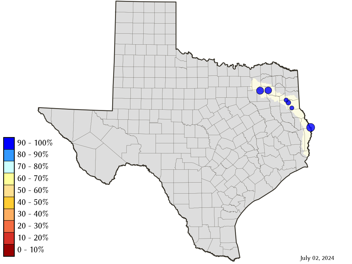
Reservoir Storage
| Reservoir | Percent Full |
Water Level (ft) |
Height Above Conservation Pool (ft) |
Reservoir Storage (acre-ft) |
Conservation Storage (acre-ft) |
Conservation Capacity (acre-ft) |
Surface Area (acres) |
|---|---|---|---|---|---|---|---|
| Cherokee | 100.0 | 280.36 | 0.36 | 46,269 | 40,094 | 40,094 | - n.a. - |
| Fork | 99.0 | 402.78 | -0.22 | 630,695 | 599,252 | 605,061 | 26,269 |
| Martin | 99.5 | 305.92 | -0.08 | 75,330 | 75,330 | 75,726 | 4,940 |
| Murvaul | 100.0 | 265.67 | 0.37 | 39,563 | 38,285 | 38,285 | - n.a. - |
| Tawakoni | 100.0 | 438.01 | 0.51 | 890,689 | 871,685 | 871,685 | - n.a. - |
| Toledo Bend 1 | 97.8 | 171.34 | -0.66 | 4,380,647 | 2,188,274 | 2,236,450 | 179,367 |
footnotes
1
Toledo Bend Reservoir straddles the border of Texas and Louisiana, Texas has rights to 50% of Toledo Bend Reservoir's total conservation capacity. Percent full, conservation storage and conservation capacity are based on the Texas share.